


<!-- WP QUADS Content Ad Plugin v. 3.0.5 -->
<div class="quads-location quads-ad1" id="quads-ad1" style="float:none;margin:10px;">

</div>

<p class="wp-block-wd-paragraph wd-dcd4b4d7">Nobody gets caught in a storm because they ignored a forecast. They get caught because they didn&#8217;t know what they were looking at.</p>


<p class="wp-block-wd-paragraph wd-955d72c4">Modern weather apps are genuinely useful — until you&#8217;re two hours into a ridge hike with no signal and the sky starts doing something you don&#8217;t recognize. At that point, the forecast is irrelevant. What matters is what&#8217;s in front of you, right now, and whether you know how to read it.</p>


<p class="wp-block-wd-paragraph wd-94b32fc5">Here&#8217;s how.</p>


<div class="wp-block-wd-divider wd-style-line wd-409b3047"></div>


<h2 class="wp-block-wd-title title wd-12317a3b">Start With the Clouds</h2>


<p class="wp-block-wd-paragraph wd-c69d8531">Clouds are the sky&#8217;s earliest warning system. Learn four and you&#8217;ll catch most dangerous weather before it arrives.</p>


<p class="wp-block-wd-paragraph wd-d431dbca"><strong>Cumulus clouds</strong> are the classic white puffy ones. Harmless in the morning. Watch them in the afternoon — if they&#8217;re growing vertically, stacking upward instead of spreading flat, they&#8217;re building toward something. A cumulus cloud that doubles in height over an hour is telling you a thunderstorm is developing.</p>


<p class="wp-block-wd-paragraph wd-862d811d"><strong>Cumulonimbus</strong> is what that cumulus becomes when it fully develops. Towering, anvil-shaped top, dark base. This is a thunderstorm cloud. If you can see one, you need to know which direction it&#8217;s moving and whether you&#8217;re in its path.</p>


<p class="wp-block-wd-paragraph wd-99fe7908"><strong>Cirrus clouds</strong> — the high, thin, wispy streaks that look like brushstrokes — indicate a warm front approaching. On their own, not dangerous. But cirrus followed over 12–24 hours by thickening mid-level clouds means rain is coming. This is the sky giving you a full day&#8217;s warning if you&#8217;re paying attention.</p>


<p class="wp-block-wd-paragraph wd-2397c736"><strong>Stratus clouds</strong> are the low, flat, grey blanket that turns everything dull. They mean persistent rain or drizzle, not violent weather — but they signal that conditions are settling in and visibility will drop.</p>


<p class="wp-block-wd-paragraph wd-1185ca44">The rule of thumb: <strong>watch for change, not just presence.</strong> A sky full of cumulus isn&#8217;t dangerous. A sky where those cumulus are visibly growing over the course of an hour is a different situation entirely.</p>


<div class="wp-block-wd-divider wd-style-line wd-fd2a2e9e"></div>


<h2 class="wp-block-wd-title title wd-7dd7f525">Read the Wind</h2>


<p class="wp-block-wd-paragraph wd-f9e4643d">Wind direction tells you what weather is coming. Wind behavior tells you how fast.</p>


<p class="wp-block-wd-paragraph wd-5fb98eda">In the Northern Hemisphere, wind shifting from south to southwest typically signals an approaching warm front — rain within hours. A shift to northwest after rain passes means cold air is moving in and conditions are clearing. Sailors and farmers have used this pattern for centuries because it works.</p>


<p class="wp-block-wd-paragraph wd-4501b69b">More immediately useful: <strong>sudden wind changes mean sudden weather changes.</strong> If you&#8217;ve had a steady breeze all morning and it abruptly dies, pay attention. That calm before a storm is real — it&#8217;s the pressure equalizing before a front hits. If wind picks up sharply and shifts direction within minutes, get to shelter.</p>


<p class="wp-block-wd-paragraph wd-5479276a">A strong, cold gust from a clear direction while a storm is visible nearby is a gust front — the leading edge of downdraft air pushed ahead of a thunderstorm. It can arrive 10–15 minutes before the storm itself. That&#8217;s your window.</p>


<div class="wp-block-wd-divider wd-style-line wd-1ef6f569"></div>


<h2 class="wp-block-wd-title title wd-f356ac9a">Watch the Pressure</h2>


<p class="wp-block-wd-paragraph wd-56ab70ec">If you&#8217;re carrying a watch with a barometer — or a dedicated weather instrument — you have one of the most reliable forecasting tools available.</p>


<p class="wp-block-wd-paragraph wd-ce3e3ffa">Falling pressure means deteriorating weather. Rising pressure means improvement. But the <em>rate</em> of change matters more than the direction.</p>


<p class="wp-block-wd-paragraph wd-2ecc4e5d">A slow, steady drop over 6–12 hours means a gradual front moving through — manageable, predictable. A rapid drop of 4+ millibars in 3 hours means a fast-moving, potentially severe system is incoming. Move quickly.</p>
<!-- WP QUADS Content Ad Plugin v. 3.0.5 -->
<div class="quads-location quads-ad2" id="quads-ad2" style="float:none;margin:10px;">

</div>


<p class="wp-block-wd-paragraph wd-20b7fd1b">No instrument? You can get a rough read from your environment. Aching joints and old injuries are folk wisdom with some physiological basis — low pressure affects fluid in joints. More reliably: smoke from a fire that hangs low and struggles to rise indicates low pressure. Smoke that rises cleanly indicates high pressure and stable conditions.</p>


<div class="wp-block-wd-divider wd-style-line wd-16675ad7"></div>


<h2 class="wp-block-wd-title title wd-fd437c7e">The 30-30 Rule for Lightning</h2>


<p class="wp-block-wd-paragraph wd-5eebcdf3">Lightning kills more people in the outdoors than almost any other weather event, and most of those deaths are preventable.</p>


<p class="wp-block-wd-paragraph wd-9cbd3fe5">The 30-30 rule is simple. After you see a lightning flash, count the seconds until you hear thunder. Every 5 seconds equals roughly one mile of distance. If that count reaches 30 or less — the storm is 6 miles away or closer — seek shelter immediately. Wait 30 minutes after the last thunder before resuming exposure.</p>


<p class="wp-block-wd-paragraph wd-859b72ae">Six miles sounds like a comfortable margin. It isn&#8217;t. Lightning can strike well ahead of the main storm cell, and storms move faster than most people walk. By the time you hear thunder at 30 seconds, you should already be moving.</p>


<p class="wp-block-wd-paragraph wd-cd7831cd">In the mountains, add urgency to everything. Ridgelines, peaks, and open meadows become lightning rods. If you&#8217;re above treeline and a storm is building, descend before it arrives — not during. The standard guidance is to be off exposed terrain by early afternoon in mountain environments, when convective storms peak.</p>


<p class="wp-block-wd-paragraph wd-ca15a830">If you&#8217;re caught in the open with no shelter: get off high ground, stay away from lone trees and water, and crouch low on the balls of your feet with your feet together — minimizing ground contact in case of a ground current strike. Do not lie flat.</p>


<div class="wp-block-wd-divider wd-style-line wd-21d3ca57"></div>


<h2 class="wp-block-wd-title title wd-920d91bc">Fog and What It Hides</h2>


<p class="wp-block-wd-paragraph wd-aad50db9">Fog doesn&#8217;t just reduce visibility — it disorients, soaks gear, drops body temperature, and masks the sound of moving water, wind shifts, and other environmental cues you depend on.</p>


<p class="wp-block-wd-paragraph wd-85f79ceb">Morning fog that burns off by mid-morning is a sign of a stable, high-pressure day. Fog that thickens or persists into midday often signals moisture-laden air that will eventually produce rain.</p>


<p class="wp-block-wd-paragraph wd-13950476">In coastal and mountain environments, watch for fog rolling in from a specific direction — it often tracks predictably along valleys and drainages. If you know the terrain, you can often stay a step ahead of it.</p>


<p class="wp-block-wd-paragraph wd-24810f1a">The underrated danger of fog is navigation failure. People who would never get lost in clear conditions walk in circles in fog because they lose reference points and unconsciously favor their dominant side. If you&#8217;re moving in fog, use terrain features — ridgelines, streams, slopes — not visual landmarks. And slow down. The second most common fog-related outdoor injury, after exposure, is falling.</p>


<div class="wp-block-wd-divider wd-style-line wd-ab3a57d7"></div>


<h2 class="wp-block-wd-title title wd-273cb0c1">Put It Together</h2>


<p class="wp-block-wd-paragraph wd-a1d88dcd">No single sign tells you the whole story. You&#8217;re looking for patterns — multiple signals pointing the same direction.</p>


<p class="wp-block-wd-paragraph wd-6f570bc1">Cirrus clouds thickening through the morning, wind shifting southwest, pressure dropping, humidity rising and the air starting to smell different (petrichor — the scent of rain on approaching air is real and detectable): that&#8217;s a full weather picture. Rain is coming in the next few hours. Act accordingly.</p>


<p class="wp-block-wd-paragraph wd-77bb4ae2">Cumulus building vertically after noon, a subtle wind shift, distant rumble you&#8217;re not sure you heard: get to lower ground, get away from exposure, and give yourself 30 minutes of margin.</p>


<p class="wp-block-wd-paragraph wd-f2f58399">The goal isn&#8217;t to become a meteorologist. It&#8217;s to close the gap between &#8220;I didn&#8217;t know&#8221; and &#8220;I had 45 minutes of warning and didn&#8217;t use it.&#8221;</p>


<p class="wp-block-wd-paragraph wd-4fb353b6">The sky is almost always talking. Most people just never learned to listen.</p>


<div class="wp-block-wd-divider wd-style-line wd-cb8785b4"></div>


<p class="wp-block-wd-paragraph wd-fbd6cdd7"><em>Best practice before any backcountry trip: check a detailed forecast, note the timing of any fronts, and identify your bailout options before you leave the trailhead. Reading weather in the field is a backup skill. It shouldn&#8217;t be your primary plan.</em>
<!-- WP QUADS Content Ad Plugin v. 3.0.5 -->
<div class="quads-location quads-ad6" id="quads-ad6" style="float:none;margin:0px;">

</div>


How to Read Weather Before It Turns Dangerous
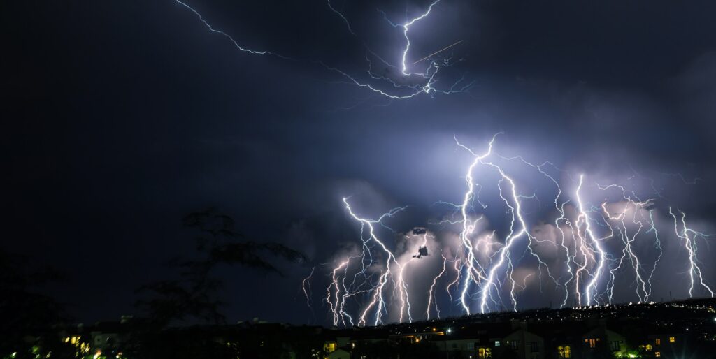
Photo by Clinton Naik on Unsplash